តាយនីញ ប្រែថាខេត្ត ជនជាតិ តាយ ដោយការដូរឈ្មោះចេញពី ខេត្ត រោងដំរី របស់ខ្មែរ ឆ្នាំ ១៧៧០។ តាមការវិភាគប្រវត្តិសាស្រ្ត ខេត្តនេះជា មជ្ឈមណ្ឌល ហ្វឹកហាត់កងទ័ពជើងគោក គឺ កងទ័ពដំរី សម្រាប់់ប្រើប្រាស់ក្នុងសង្រ្គាម ជាមួយ ចាម ជាមួយ លាវ សៀម យួន ជាពិសេស ជាមួយ ពួកម៉ុងហ្គោល ដែល កងទ័ពខ្មែរសម័យនោះមានទ័ពដំរីជាង ១ លានក្បាល ដើម្បី ធ្វើសង្រ្គាមជាមួយ ទ័ពម៉ុងហ្គោល ចូលឈ្លានពាន ចេញពី លាវ និង ចម្ប៉ា។
The Tày people, also known as the Thổ, T'o, Tai Tho, Ngan, Phen, Thu Lao, or Pa Di, are a Central Tai-speaking ethnic group who live in northern Vietnam. According to a 2009 census, there are 1.7 million Tày people living in Vietnam. This makes them the second largest ethnic group in Vietnam after the majority Kinh (Vietnamese) ethnic group. Most live in northern Vietnam in the Cao Bằng, Lạng Sơn, Bắc Kạn, Thái Nguyên, and Quảng Ninh provinces, along the valleys and the lower slopes of the mountains. They also live in some regions of the Bắc Ninh and Bắc Giang provinces. They inhabit fertile plains and are generally agriculturalists, mainly cultivating rice. They also cultivate maize, and sweet potato among other things.
The chhay-dăm drum dance of the Khmer in the province has been recognised as a national intangible cultural heritage. The province has 12 cultural houses for its minorities, including the Khmer, Tà Mun and Chăm.
TÂY NINH — The south-eastern province of Tây Ninh has implemented a number of policies to improve the lives of ethnic peoples. It has 21 ethnic groups with 21,410 people, who account for 1.71 per cent of its total population. The Khmer, Chăm and Hoa account for the largest numbers.
To improve the lives of the ethnic people, the province has allotted them farming and housing lands, provided jobs and helped preserve their traditions and cultures.
In Bến Cầu District, Long Phước Commune has 40 Thái ethnic families with 140 members.
Hồ Thanh Hải, chairman of the commune People’s Committee, said the province had a policy of providing each ethnic household in the commune 400sq.m of housing land and two hectares of farmland in 1994.
Hà Duy Khuyền, an ethnic Thái man living in Long Phước, moved from the central province of Thanh Hoá to Tây Ninh. He said: “When I came here, I had no land. In 1994 my family was given housing land and farmland.” He and his wife worked hard on the lands and saved up to buy more, and his family now has seven hectares, he added. Most Thái houses in the commune are built of concrete and bricks.
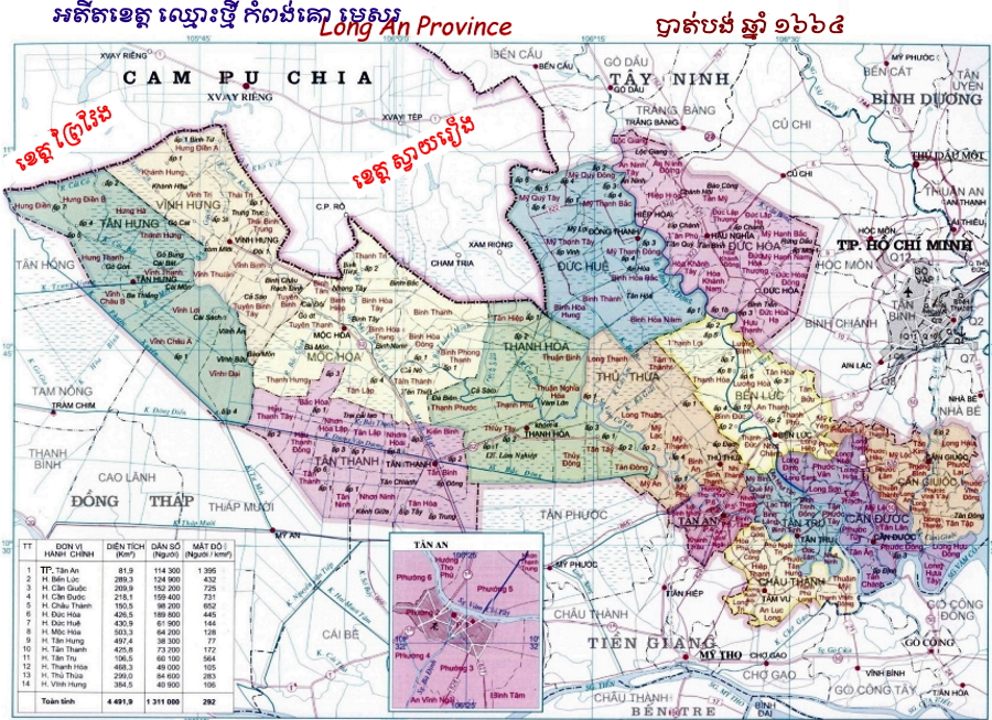
រោងដំរី (យួនៈTây Ninh) ជាខេត្ក ខ្មែរមួយ នៅដែនដី កម្ពុជាក្រោម ឋិតនៅក្នុងតំបន់ដូនណៃ ឬ ភាគខាងកើត ដែនដីសណ្តទន្លេមេគង្គ ។ ( ផែនទី អតីតខេត្ត រោងដំរី សម័យ បារាំង គ្រប់គ្រង)
ទីតាំងភូមិសាស្ត្រ៖ ទិសខាខលិច និងខាងជើងជាប់ ព្រំប្រទល់ នឹងប្រទេសកម្ពុជា ។ ខាងកើតជាប់នឹងខេត្តទួល តាមោក [បច្ចុប្បន្នៈ ខេត្ត បិនយឿង (Bình Dương និងខេត្តបិនភឿក (Bình Phước) ។ ខាងកើតមាន ព្រំប្រទល់ជាប់ នឹងទីក្រុងព្រៃនគរ និងខេត្តកំពង់គោ (Long An) ។
ផ្ទៃដី៖ បច្ចុប្បន្ន ខេត្តរោងដំរីមានផ្ទៃដី ៤.០២៩,៦ Km2 ។
ភូមិសាស្ត្រ៖ ខេត្តរោងដំរីជាតំបន់មួយ ដែលមានភ្នំ វាលទំនាបស្មើ និងមានទេសភាពដ៏ស្រស់ត្រកាល គួរជាទីគយគន់នៃភ្ញៀវទេសចរណ៍ ទាំងឡាយ ។
ភូមិសាស្ត្រ៖ ខេត្តរោងដំរីជាតំបន់មួយ ដែលមានភ្នំវាលទំនាបស្មើ និងមានទេសភាពដ៏ស្រស់ត្រកាលគួរជាទី គយគន់នៃភ្ញៀវទេសចរណ៍ ទាំងឡាយ ។ ព្រៃរោងដំរី មានដើមឈើមានតម្លៃជាង ២០០ មុខ សត្វព្រៃ ចំនួន ២៥០ ប្រ ភេទ ក្នុងនោះមានសត្វពស់ អណ្តើក ជាដើម ។
រដ្ឋបាលភូមិសាស្ត្រ៖ បច្ចុប្បន្ន ខេត្តរោងដំរីរដ្ឋាភិបាលបក្សកុម្មុយនិស្តយួន បានចែករដ្ឋបាល ភូមិសាស្ត្រចេញជា ៨ ស្រុក និងមជ្ឈមណ្ឌលទីរួមខេត្តមួយ។ មជ្ឃមណ្ឌលទីរួមខេត្តនៃខេត្តរោងដំរី គឺទីរួម ខេត្តរោងដំរី (thị Xã Tây Ninh) ។
ពលរដ្ឋ៖ ខេត្តរោងដំរី មានប្រជាជនសរុបទាំង អស់ចំនួន ១.០២៩.៨០០ នាក់ ។
វប្បធម៌៖ ស្ថាបត្យកម្មខ្មែរ ដូចជាព្រះវិហារ និងកេរដំណែលបុរេប្រវត្តិសាស្ត្រ បានត្រូវគេវាយតម្លៃយ៉ាង ខ្ពស់ថា ជាខឿនអរិយធម៌ ដ៏រុងរឿងមួយ ដែលមានវត្ត មានឆាប់បំផុតនៅកម្ពុជាក្រោម ។
វត្តខ្មែរក្រោមមាន ៥ គឺ៖1. បុញ្ញចន្ទរង្សី (បុណ្យ)
2. សុរិយរង្សី (ក្បាលស្ពាន)
3. គុជសារង្សីគម្ពីរបព៌ត (រោងដំរី)
4. គម្ពីរវនមង្គល (ក្រអូប)
5. សូភីវនមង្គល
ផែនទីខេត្ត នានា របស់ប្រទេសវៀតណាម


